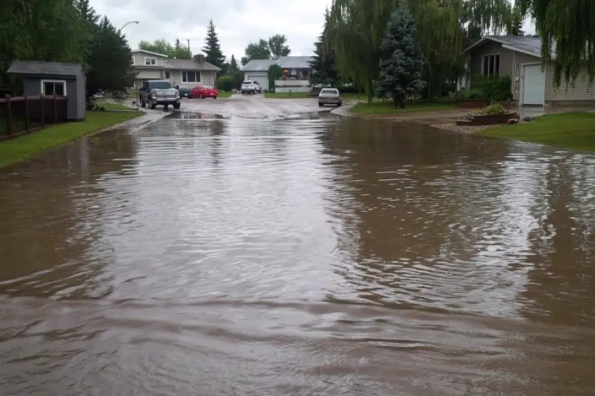
Rainfall warnings were issued Tuesday morning for swaths of southwest and central Saskatchewan, touching on the Manitoba, Alberta and U.S. borders.
“For the last two or three days, you’ve been getting almost two-months’ worth of rain in some communities,” said Environment Canada Meteorologist David Phillips on the Brent Louck’s Show Monday.
Cities such as Estevan, which declared a state of emergency Sunday night; Lloyminster and Humboldt were pelted by heavy rains that backed up drains and flooded streets and infrastructure.
“We saw this weather system that just didn’t want to go away. It just sort of stuck over the province, it lingered on and produced some heavy amounts of rain,” Phillips said.
“Mercifully, Estevan got very little rain yesterday (Monday). They got sort of the opening act there on Sunday, with unofficial reports of 130 millimetres – that would be an all-time record for that city.”
This is the current state of Wade Bye’s house. His house is on one of the worst streets in #Estevan #skstorm pic.twitter.com/1plXqVAPNG
— Sarah Mills (@smillsSK) July 11, 2016
Environment Canada shared rainfall totals, as of 4 a.m. Tuesday, for the hardest-hit areas the day before:
- Watrous: 60 millimetres
- Swift Current: 55 millimetres
- Melfort: 40 millimetres
- Saskatoon: 20 to 25 millimetres
Warnings Tuesday stretch from the southwest corner around Cypress Hills up north to Kindersley then in a diagonal band through Moose Jaw, Watrous, Saskatoon, to the east central region up to Melfort, Hudson Bay and Porcupine Plain.
On a positive note, Environment Canada meteorologist James Cummine said the worst of the rain is over for the province.
“The heaviest rain showers have fallen and there could be some very localized ones, but a lot shorter today and nothing like what Estevan saw on Sunday,” he said Tuesday morning.
Some areas could see another 20 millimetres, or less than an inch.
“Normally that wouldn’t be very much at all, but given how wet it’s been, I’m thinking even 10 millimetres in a short period of time will still cause pooling on the ground,” Cummine said.
Environment Canada said after the rain dissipates, which is anticipated Wednesday, it’s expected to be nothing but sunshine for four or five days straight.
Home of the Funnel Cloud
Throughout the last few days of rainfall, funnel clouds have been spotted across the province – and all over social media.
Many people expressed concerns about the severity of weather needed to produce the ominous clouds; however, meteorologist David Phillips said Saskatchewan is the home of the funnel cloud, with dozens often appearing in one day.
“They certainly have a look to them, but they often occur with not severe weather; they might not even have precipitation associated with them,” he said.
The meteorologist said the big difference between a funnel cloud and a tornado is that the former never touches the ground.
“It strictly is a cloud formation that reaches down to maybe middle levels,” he said.
Phillips does caution residents to “respect funnel clouds,” and take it as a sign of possible severe weather ahead.
Tornadoes occur an average of 12 times a year in Saskatchewan, and those also have some warning signs.
“You get tornadoes with a super cell; when you look up and see that green sky and a whole mass of cloud just rotating around like a barber’s bowl,” Phillips said.
Environment Canada urges people to seek shelter and safety anytime there is severe weather; however, if residents capture photos or video of an event, the agency appreciates submissions to better monitor weather events.


