Snow news is good news for Saskatchewan.
After a recent dump of snow, most of the province is now expected to see normal to above-normal runoff levels this spring.
On Tuesday, the Water Security Agency (WSA) released an updated outlook, confirming the early March snowfall across much of southern Saskatchewan has raised projections.

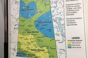
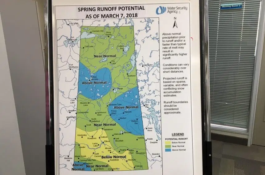
Water Security Agency map shows the forecast for spring run-off has changed after the big snowstorm, March 13, 2018. (Adriana Christianson/980 CJME)
The WSA initially projected a below-normal runoff for southern Saskatchewan after dismal moisture conditions at freeze-up time in 2017 and low snowfall amounts through early winter.
But from March 3-5, the southeastern areas of the province saw between 20-45 centimetres – around eight to 18 inches – of snow, elevating the numbers for spring runoff.
“We were really below normal and as we found out one snowfall event can change the picture pretty quickly,” said Patrick Boyle with the WSA.
He said the big snowfall will provide welcome relief for many producers who were dealing with very dry soil conditions going into the fall.
Assuming near normal conditions going forward to the melt, a band stretching through the North Battleford, Saskatoon, Regina and Yorkton areas is now expected to get a near-normal snowfall runoff, as is the northern boreal forest.
Spring runoff is expected to be above-normal for the Prince Albert area, as well as Buffalo Narrows, Hudson Bay, Nipawin and the extreme southwest corner of the province. All those spots saw above-average precipitation through 2017 and this winter.
While flows are anticipated to be higher than normal in these areas, the WSA reported flood levels are not anticipated at this time.
More moisture needed for agriculture
The WSA noted it’s still likely there will be drier pockets in southwest and south-central parts of the province.
While the early March snowfall improved conditions somewhat, a band stretching southeast from Kindersley through Swift Current and Moose Jaw and down through to Estevan is projected to experience a lower than normal spring runoff.
Boyle said even in the areas with below normal runoff projections, soil conditions for farmers are better than they were last month.
“Some of those areas went from well below normal and then got this snowfall event to moving up a level to below normal and then other areas went to near normal,” Boyle said. “So for the most part, fairly good news.”
The WSA noted more moisture is needed before summer months to address potential agricultural and municipal water supply shortages in these areas.
Boyle said daytime high and low temperatures swinging between 5 C and -5C and actually represent the ideal conditions for a slow melt, noting problems with flooding arise if the temperature stays above freezing overnight.
“That’s the sweet spot, that’s what we’re looking for,” he commented, referring to the weather this week.
Naturally, there could be a big change in the spring runoff forecast in either direction depending on big weather events like another snowstorm or heavy rains.
At this time, WSA projects all major water supply reservoirs will have adequate supplies in 2018, due to previous years of high runoff and careful water management.
The WSA added good flows on the Saskatchewan River system are expected in 2018, thanks to an above-average snowpack throughout the eastern slopes of the Rocky Mountains.


