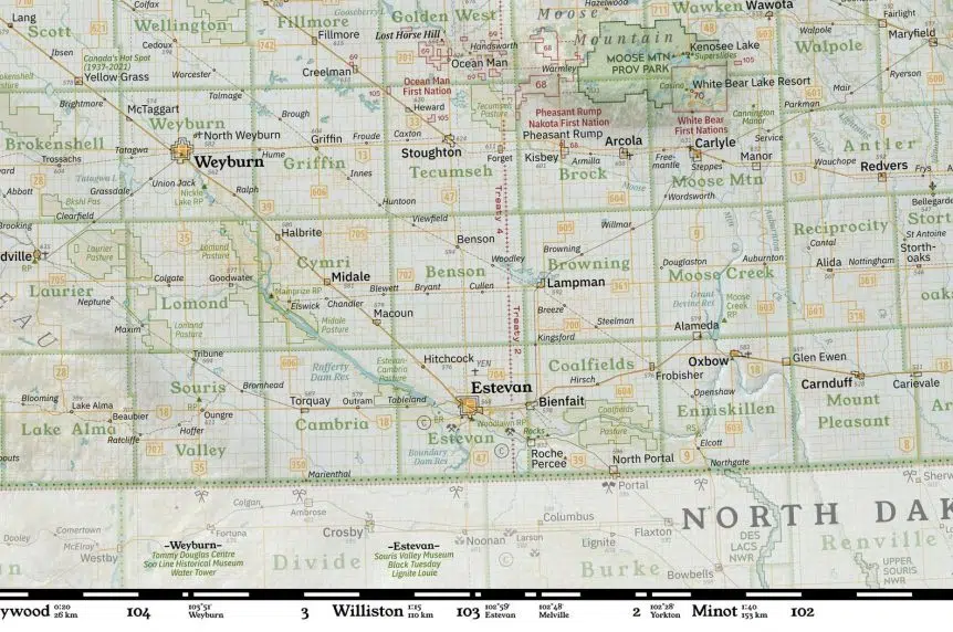
A custom wall map built by a Val Marie native is nearing the closing stages.
Alex McPhee has logged well over 500 hours on this project and has just a couple of areas in the northern part of the province to finish before the final unveiling.
“I have two RM’s left to finish. Meadow Lake and Hudson Bay which happen to be just about the two biggest,” McPhee said on Gormley.
“Then I’m probably going to have to spend two months labelling every single creek in the far north, which is going to take up about half of the printed real estate on this thing.”
Over the last year, McPhee has spent countless hours adding every important detail he could think of.
“I have gotten most of the labels placed in the southern portion of the province including the location of every grain elevator that ever stood, every museum that I think is noteworthy and every TLE (Treaty Land Entitlement) parcel which changed month to month.”
One of the best parts of creating a custom map is that McPhee has the final decision on what belongs and what doesn’t.
“A lot of it is completely subjective, which is actually why I’m really happy to be an independent.”
If you take McPhee’s map and compare it to what you might see on Google Maps, there are plenty of differences to pick apart and for plenty of good reasons.
“The funniest thing about Google Maps is that their biggest priority is actually selling ads. So the points of interest that you see first are usually companies (that) have paid to get that priority,” McPhee said.
“What you’re seeing on Google reflects basically what people have put thousands of dollars into. But that’s not so good for conveying information about history or community interests.”
The 23-year-old cartographer says it helps that he’s been able to see almost all of Saskatchewan prior to starting this project.
“I think I’ve read through the entire Tourism Saskatchewan directory. I try to travel as much as I can. So far, I have made it to 90 out of 296 RM’s.”
“If something is important to the life of the community, if there’s a historic marker that I think more people should know about because it’s sincerely interesting, that’s the kind of thing that I make sure gets pride of place on my wall map.”
Another aspect that makes this map so unique is the relief shading that helps give a sense of the vertical landscape Saskatchewan has.
McPhee has a degree in geophysics and says it was incredibly useful in this aspect of the map.
“Saskatchewan’s landscapes are way more interesting than people give them credit for.”
“My claim to fame is that I have made my own relief shading algorithm from scratch that’s especially suited to these glacial landscapes.”
The map has roughly two more months worth of work left, according to McPhee.


