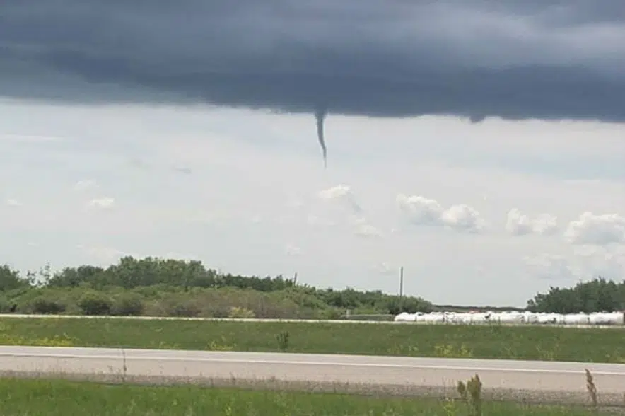
Conditions are right for the formation of funnel clouds in parts of the province.
Environment Canada issued a weather advisory Tuesday afternoon, covering the areas around Carrot River, Duck Lake, Melfort, Nipawin, Prince Albert, Shellbrook, Spiritwood and Tisdale, saying conditions are favourable for funnel clouds to develop.
“We did have the possibility of tornadoes in one of the areas that stretched more through central Saskatchewan and right now there is a funnel cloud advisory for areas a little bit further north than Saskatoon including Prince Albert,” Environment Canada meteorologist Samantha Mauti said.
The threat in that area is expected to end in the late afternoon, the weather service noted.
“These types of funnel clouds are generated by weak rotation under rapidly growing clouds or weak thunderstorms. This weak rotation is normally not a danger near the ground. However, there is a chance that this rotation could intensify and become a weak landspout tornado,” Environment Canada said in a statement.
“Landspout tornadoes do not usually cause significant damage but can still be dangerous. They can be strong enough to topple trees, damage roofs or toss debris short distances.”
All sightings of funnel clouds should be treated seriously, the weather service cautioned, and anyone who spots one should be prepared to take shelter immediately as the funnel clouds can appear quickly with little or no warning.
Mauti said there was the possibility of showers and thunderstorms in southeastern Saskatchewan as well.
She said the system should be gone by Wednesday afternoon, but some southeastern areas might still deal with lingering rain until it passes into Manitoba.
Storm chaser watching system closely
Storm chaser Jenny Hagan said she has been keeping an eye on a weather system moving through Saskatchewan over the past few days.
“We’ve got that front that’s moving through central Saskatchewan today, and there’s a good possibility in around Saskatoon over to Yorkton for funnel clouds or landspout tornadoes as this system moves east,” Hagan said.
Hagan said she expects the system to progress through the province Tuesday afternoon and move over to the Manitoba border Tuesday evening.
While Regina might experience some rainfall Tuesday and Wednesday, Hagan said the city is just outside of the risk area for potential tornadoes.
“A lot of the tornado risk is going to be east of there,” she said.
The other area of interest Hagan highlighted was in the southeast corner of the province, south of Moosomin.
“Definitely keep an eye on Environment Canada watches and warnings and if you’re in those areas, make sure that you’ve got your plan for a safe spot if those systems move through,” Hagan said.
“And I always let people know if a storm looks like it’s not moving, it’s probably coming straight for you, so make sure you take some cover.”
Thunderstorm watches, warnings issued for eastern Sask.
Meanwhile, severe thunderstorm watches and one warning were issued for parts of eastern Saskatchewan on Tuesday afternoon.
The watches were in effect for areas around Moosomin, Rocanville, Yorkton, Melville and Esterhazy, while the single warning was in effect for the RM of Wallace.
Severe thunderstorm watches mean conditions are right for the development of major storms, while warnings mean the storm has already developed or is imminent.
“This developing thunderstorm is located just northeast of Yorkton and is moving to the southeast,” Environment Canada said in a statement.
The weather service said the storm is “capable of producing strong wind gusts, up to nickel size hail and heavy rain.”
The latest information on the alerts can be found on Environment Canada’s website.
–With files from 980 CJME’s Daniel Reech


