

Murray Wood: Conservative floor crossers could hand Mark Carney a majority government
Murray Wood says Prime Minister Mark Carney is happily accepting floor crossers from the Conservatives, but maybe it's t...
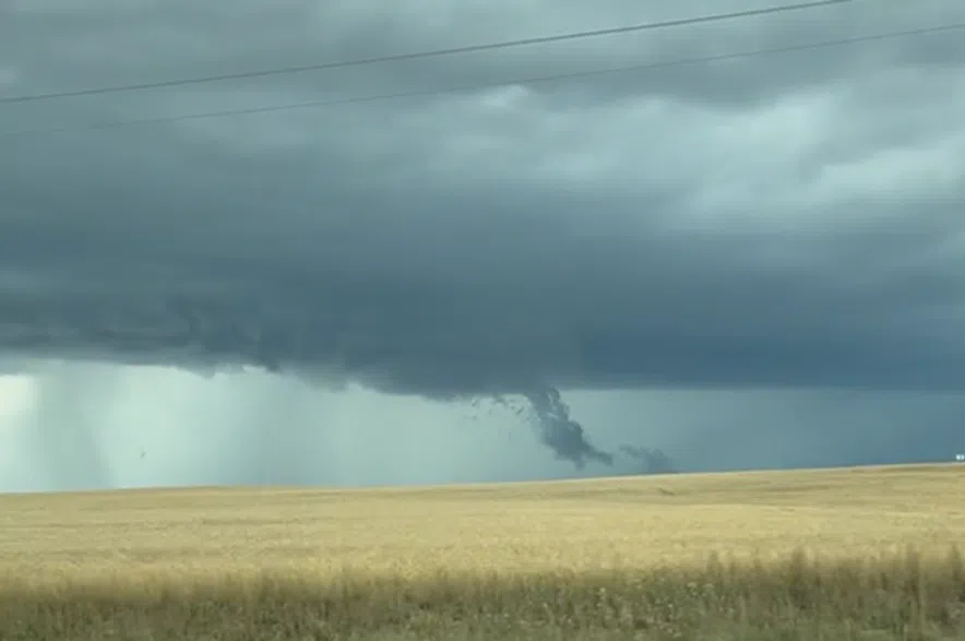
Large hail, strong winds, and funnel clouds hit parts of Saskatchewan on Wednesday as wicked storms rolled through the province.
Environment Canada was keeping an eye on severe storms moving through central Saskatchewan starting on Wednesday afternoon and lasting into the night. Severe storm watches covered most of west-central Saskatchewan on Wednesday, with a couple of severe storm warnings also in place next to the Manitoba border.
Read more:
Meteorologist Robyn Dyck said the stormy weather was due to a low-pressure system and a cold front that crossed southern Saskatchewan, bringing severe thunderstorms into the province.
“Initially they were just like little individual cells, and then they quickly grew into a pretty decent long line along the cold front, and it just wiper-bladed across the province,” Dyck explained.
Quite the storm this evening. Lots of trees down south of clavet, defoliation of some trees on windward side of bushes, bin tipped, and a new house among the casualties 😬. #skstorm pic.twitter.com/MtOGO4NnY9
— Phillip Harder (@harder_water) August 14, 2025
Dyck said it was a fast-moving storm that brought a handful of funnel clouds with it, but there were no reports of tornadoes touching down.
She said the storm also generated strong winds, hitting speeds up to 91 km/h in North Battleford.
Brenda Dutertre said she spotted a funnel cloud on the highway between Battleford and Lloydminster, east of Creighton.
Brenda Dutertre said she spotted a funnel cloud on the highway between Battleford and Lloydminster, east of Creighton, on Wednesday.#skstorm #saskatchewan pic.twitter.com/Dlba7LVTeu
— 650 CKOM (@CKOMNews) August 14, 2025
She said she got a tornado alert on her phone, and then looked up and spotted what appeared to be a tornado.
“Where we were it was windy, but I don’t think we were very close to it,” she said.
Dutertre grabbed a video of the funnel cloud, but said it wasn’t clear if it was touching the ground.
“It looked like it might have been, but we couldn’t see because it was so far away,” Dutertre said.
“There was definitely a funnel.”
According to Dyck, large hail fell in communities north of North Battleford. She said hail the size of chicken eggs hit Delmas, hail the size of ping pong balls fell in Paynton and Glidden, and golf-ball-sized hail was reported in Aquadeo.
It was a scary early afternoon here in Midwest Saskatchewan, 🇨🇦, 13 Aug 2025.
— Kid Krayon (@kidkrayon) August 13, 2025
We had a horrible thunderstorm & hailstorm; with strong winds.
There is widespread damage in my area; mainly to vehicles & flora.
🌬⛈️😱🙀🙏🏻
Cc: @Diamondthedave @ZT_Followers#SKStorm #hail #StormHour pic.twitter.com/JkBbSxfQBQ
“I think those are the biggest reports, or the most severe reports we received,” the meteorologist said.
“With that type of (storm), you can get downburst winds from thunderstorms, and that can produce severe damage as well… But no damage was reported.”
Meanwhile, as much as 56 millimetres of rain fell in an area between Meadow Lake and Prince Albert over a 12-hour period.
In the Northern Grain Belt, between 10 and 20 millimetres of rain fell during the storms, though a few areas may have received more.
But according to Dyck, the weather office’s numbers indicate only two millimetres of rain fell in Saskatoon.
“Because the thunderstorms were very isolated in nature, they didn’t hit any of our stations, so that’s why even Saskatoon only reported around two millimeters,” she said.
“Whereas in the north, in central Saskatchewan or the Northern Grain Belt, the thunderstorms were not just individually isolated, but they were like a regrouping, like a long line or a cluster, so it was a larger area of showers that went through.”
Dyck said the storms moved into Manitoba early on Thursday, with no thunderstorms expected in Saskatchewan for the rest of the day.
“There’s a ridge of high pressure that is moving in, so most of the forecasts are some sort of clearing trend, although, because you are behind the cold front now, temperatures will be a little cooler than we’ve been experiencing recently,” Dyck said.
She said it is also expected to be windy on the backside of the low-pressure system, with wind gusts potentially reaching around 60 km/h on Thursday.