

Sarah Mills: There is still some skepticism about ice skating judging
Canada's ice dancing bronze medal should be celebrated, but Sarah Mills says the stink of Salt Lake City and the judge v...
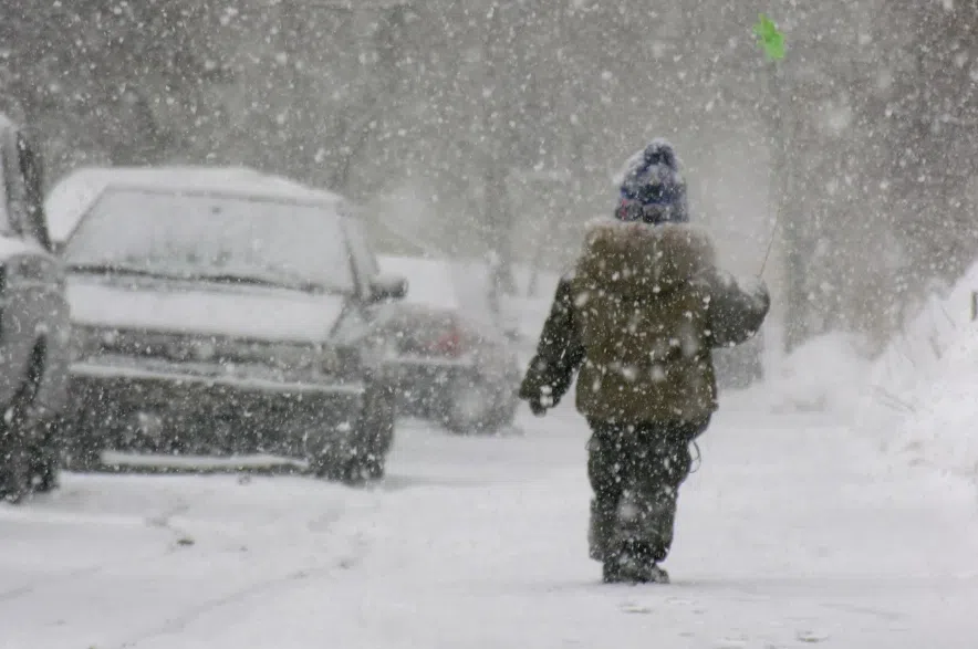
The Weather Network is warning of a “powerful and disruptive” winter storm headed into the province later this week.
Before that storm hits, though, a strong cold front will sweep across the region bringing strong northwest winds with gusts to 90 km/h expected to develop on Monday night or Tuesday morning, Environment Canada said.
Read more:
The biggest storm, forecast to arrive on Wednesday and continue through Thursday in parts of the southern Prairies, will bring heavy snow of up to 15-30cm and strong winds, the network said.
It warned that the intense Alberta clipper moving through will mean rapidly accumulating snow that will cause near-zero visibility in places at times.
Areas along the Yellowhead Highway will be hardest hit, where the network warned of dangerous driving conditions with possible whiteouts.
The storm is forecast to hit southern Saskatchewan late Wednesday morning, with snow becoming heavy in the afternoon with wind gusts of up to 110 km/h or more.
The network also said a “flash freeze” would also likely hit southern areas of the province, with temperatures plunging by 15 to 20 degrees in just six hours, with widespread road closures and power outages possible.
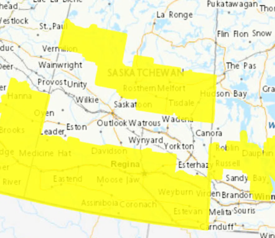
Warnings about strong winds and freezing rain were issued for much of the southern part of the province on Monday night. (Environment Canada)
The cold front forecast for Monday or Tuesday morning will bring strong northwest winds with gusts to 90 km/h expected, Environment Canada said.
Yellow wind warnings were issued on Monday afternoon for Regina, Fort Qu’Appelle, Moose Jaw, Swift Current, Estevan, Weyburn as well as a number of RMs, while yellow freezing rain warnings were issued for Prince Albert, Duck Lake and Hudson Bay as well as a handful of RMs.
Environment Canada is using new colour-coded alerts. Every type of weather alert — warnings, advisories, and watches — now has a colour when it is issued moving from yellow, to orange and then red as the potential risk increases.
This winter is considered to be a “typical La Niña winter,” Environment Canada’s Jennifer Smith told CJME News last week.
“We’re certainly seeing that classic La Niña signature to start the season with colder temperatures moving in … and I think we will continue to see some Arctic blast cold spells throughout the first part of the winter season, interspersed with some warm-ups,” Smith said.
She said it’s possible the province will receive more snowy conditions, which is also another hallmark of La Niña events.
Read more: