

Wood file: Canada can lose occasionally and still be No. 1
Canada was snakebit in the gold medal hockey game, and sometimes, even when you dominate the other team, you come up sho...
Mother Nature is providing a mixed bag of very unpleasant weather conditions across Saskatchewan today.
Snow will continue in many areas, fog is flooding southern parts and northerly winds will deliver frigid temperatures and wind chill values that carry a high risk of frostbite.
Read more:
People in Regina can expect periods of snow with amounts of 2 to 4 cm and possibly freezing drizzle, with bowing snow in outlying areas. Temperatures tonight will fall to -16 C with a wind chill of -30 C.
In The Battlefords those wind chill values will near -34 C.
Saskatoon, Martensville, Humboldt and Warman will get more snow — also around 2 to 4 cm — with overnight temperatures of -25 C, and a wind chill of -35 C.
In Moose Jaw there will also be 2 to 4 cm of snow, with wind chill nearing -36 C overnight., and Swift Current can expect the same amount of snow, with wind chills dropping to -38 C tonight.
Prince Albert and Meadow Lake will get around 5 cm of snow today, and see a wind chill of -31 C tonight.
Environment Canada has issued blowing snow advisories for a large area of Saskatchewan, saying that freshly fallen snow combined with strong northwest winds will reduce visibility, making travel hazardous due to near-zero visibility. Wind chill values between -30 C and -40 C are also expected.
The blowing snow advisories cover Lloydminster, Estevan, Kindersley, Biggar, Carmichael, North Portal, Cowessess Res., Osage, Ocean Man Res., Kipling, Carnduff, Piapot, Rocanville, Wolseley and a number of RMs.
Find a full list of blowing snow advisories here.
Fog advisories were also issued for parts of southeastern Saskatchewan, where near-zero visibility is expected before as a cold front ushers in colder, drier Arctic air from the north.
The fog advisories were issued for Swift Current, Weyburn, Golden Prairie, Lucky Lake, Northgate, Gull Lake, Carlyle, Moosomin, Rosetown, Wolseley and a number of RMs.
Find a full list of fog advisories here.
Environment Canada’s wind chill index uses research from human volunteers and advanced computer technology to present a forecast representative of what people actually feel.
By equating the outdoor conditions to an equivalent temperature with no wind, the index represents the degree of “chill” that your skin senses. For example, if the wind chill is -20 C while the outside temperature is only -10 C, it means that your face will feel as cold as if it was a calm day (no wind) with a temperature of -20 C.
Environment Canada also provides a wind chill calculator on its website.
Wind chill values over -10 C and up to -27 C are considered moderate risk and bring the possibility of hypothermia and frostbite if outside for long periods without adequate protection, the weather agency says.
Wind chill values of up to -39 C are considered high risk and exposed skin can freeze in 10 to 30 minutes, while values of -40 C to -47 C are very high risk, and exposed skin can freeze in 5 to 10 minutes
If wind chill reaches -48 C to -54 C it carries a severe risk, with exposed skin able to freeze in
2 to 5 minutes, above -55 C and colder the risk is extreme and exposed skin can freeze in less than two minutes.
Wind chills below -70 have been recorded in some northern Canadian communities.
A normal body temperature is approximately 37 C. When the core body temperature drops by 1 or 2 C, or your body is exposed to severe cold it increases your risk of harmful effects.
With frostbite, nerve damage occurs and frostbitten skin becomes discoloured and turns black.
Frostbite generally occurs in body parts furthest from the heart like hands, feet and the nose. It is an injury that leads to the loss of colour and feeling in extremities due to freezing temperatures.
Frostbite can permanently damage the body and nerve damage can become so severe that you will lose feeling in the affected area and blisters will occur. If the skin is broken and becomes infected, gangrene can set in which can result in the loss of limbs.
Symptoms of frostbite include redness or pain in any skin area, and can cause skin to appear white or grayish yellow in colour, become hard to the touch, and become very firm or waxy.
Blisters may develop on frostbitten skin, and a person who has frostbite may not know they have it until someone else points it out, because the frozen parts of the body are usually numb.
Those more at risk of developing frostbite include babies due to their underdeveloped ability to regulate body temperature, elderly people as they produce less body heat, and those with certain health conditions.
The use of alcohol and exhaustion also increases risk of frostbite, as judgment regarding bundling up and feeling cold may be impaired.
Frostbite is also often tied to hypothermia, which can be identified by shivering, confusion, and loss of muscular control. Both conditions require immediate medical attention.
Cold weather can also interacts with some medications, affecting the body’s ability to maintain or regulate body temperature.
Someone with signs of frostbite should get into a warm room as soon as possible and seek professional medical attention if possible.
Unless absolutely necessary, do not walk on feet or toes that show signs of frostbite — this could increase the damage.
Do not rub the frostbitten area with snow or massage it at all. This can also cause more damage.
Put the areas affected by frostbite in warm, but not hot, water. The temperature should be comfortable to the touch for the unaffected parts of the body.
Do not use heating pads, heat lamps, or the heat of a stove, fireplace or radiator for warming, because affected areas that are numb can easily get burned.
Wear clothing appropriate for the weather. Synthetic and wool fabrics provide better insulation., and some synthetic fabrics are designed to keep perspiration away from your body which keep you dry and further reduce your risk.
Dress in layers with a wind resistant outer layer. You can remove layers if you get too warm (before you start sweating) or add a layer if you get cold.
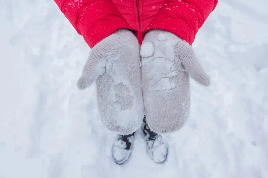
Wear warm socks, gloves, a hat and scarf in cold weather. Be sure to put a scarf over your nose to protect it.
If you get wet, change into dry clothing as soon as possible. You lose heat faster when you’re wet.
Wear a face mask and goggles if you are participating in winter activities such as skiing, snowmobiling and skating to protect your face.
Keep moving (especially your hands and feet) to keep your blood flowing and maintain your body heat.
If you are caught in a severe snowstorm, or outside in extreme cold conditions, look for shelter. If there are no buildings around, a small cave, ditch, hollow tree or a vehicle can help reduce your chances of frostbite or hypothermia. Even if you find shelter, keep moving to maintain your body heat.
Read more: