


Murray Wood: The new phone books are here!
Once a Steve Martin catchphrase, Murray Wood says physical phone books are rapidly becoming relics of another age, but t...
Wildfire smoke prompted special air-quality warnings across Saskatchewan, with some of the worst air expected in La Ronge and Buffalo Narrows, as the number of active fires burning in the province on Saturday jumped to 73.
The poor air quality that is expected to persist into Sunday for some areas, according to Environment Canada.
Read more:
Air quality alerts from wildfire smoke also span the country, stretching from eastern British Columbia and into western Quebec.
Air quality warnings require the air-quality health index rating to be at 10 or higher for at least six consecutive hours, said Serge Besner, a meteorologist with Environment Canada.
Meanwhile, special air-quality statements are issued when poor air-quality index ratings are around a seven, but less than 10.
Areas with the poorest air quality were largely contained to the northern parts of Ontario, Manitoba and Saskatchewan, Besner said.
Environment Canada’s air quality index can be found here.
You can take a look at the ratings in communities across your province or territory.
A rating of 1-3 is low risk, 4-6 is moderate risk, 7-10 is high risk and over 10 is very high risk.
The risk designations can change regularly in the same community, Environment Canada says, so it’s important to keep checking the air quality forecast.
Environment Canada, in consultation with Health Canada, has different recommendations for people especially at risk of suffering health problems when exposed to poor air quality compared to the general population.
“At risk” people include those with respiratory issues such as asthma, chronic obstructive pulmonary disease (COPD), pneumonia, as well those with as heart disease. Infants, young children, pregnant people and elderly people are also considered at higher risk.
The government agency lists the various health conditions that put you at higher risk at this website.
“Low risk” means everyone can safely be outdoors.
“Moderate risk” means the general population doesn’t need to change their usual outdoor activities unless they have symptoms such as coughing and throat irritation. But people at risk should “consider reducing or rescheduling strenuous activities outdoors.”
“High risk” means those at risk should reduce or reschedule strenuous activities outdoors. Children and seniors should “take it easy.” The general population should consider reducing or rescheduling strenuous activities if they start coughing or their throats become irritated.
“Very high risk” means everyone should reduce or reschedule strenuous activities. People at risk should avoid outdoor activities altogether.
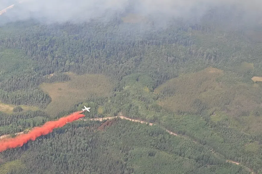
The Buhl Fire was caused by a lightning strike and on Friday has burned about 12,692 hectares within Prince Albert National Park boundaries and 74,114 hectares on provincial Crown land. (Parks Canada/Facebook)
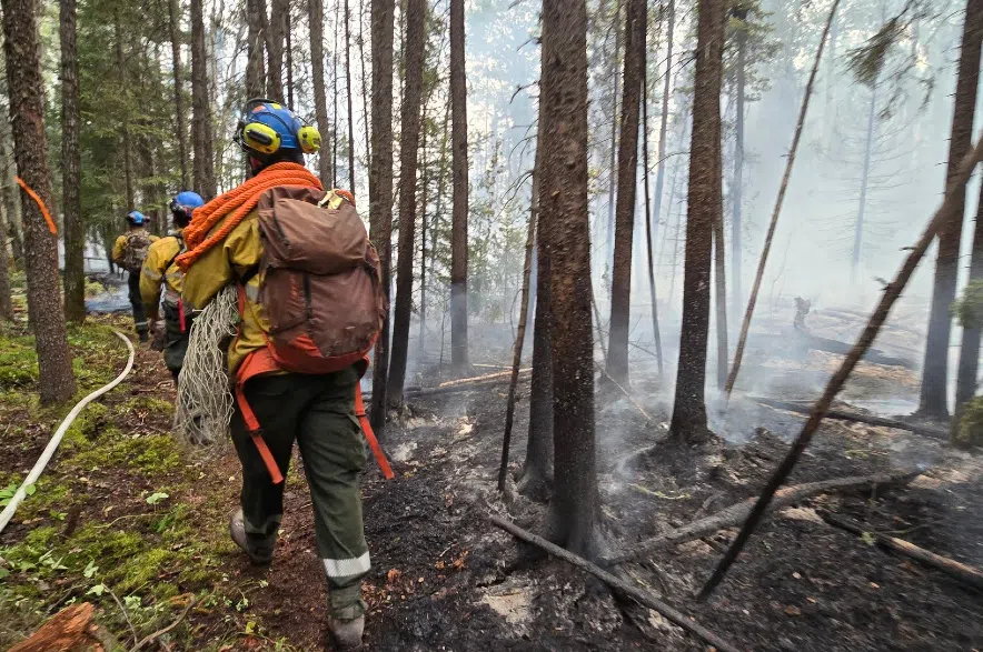
Saskatchewan Public Safety Agency (SPSA) said in a 2:30 p.m. report that of the 73 active fires, 16 of those blazes were not contained, while another 38 of the fires were under ongoing assessment and firefighters were protecting values in 15. Only four fires were considered contained.
Contained means suppression action is taking place and the fire is not expected to grow in size, ongoing assessment means the fire is being monitored regularly to assess risk to values in the area and not contained means suppression action is taking place but the fire is expected to grow in size, according to SPSA. Protecting values means a fire is active and action is focused on protecting things like cabins and infrastructure.
Significant fires that are not contained include the Shoe Fire near Lower Fishing Lake, which was 565,701 ha is size; the Pisew Fire west of La Ronge, which was 207,090 ha; the Ditch Fire north of Weyakwin, which was 192,730 ha; the Muskeg Fire north of La Plonge Indian Reserve and Beauval, which was 313,680 ha.; the Buhl Fire west of Weyakwin and in Prince Albert National park, which was 83,051 ha; the Trail Fire west of Beauval, which was 41,553 ha; and the Park Fire north of La Roche, which was 26,838 ha.
As well, fire bans are active in 14 urban municipalities, 24 rural municipalities and four provincial parks in the province, with the fire danger considered high to extreme over all but southeastern parts of Saskatchewan.
SPSA says there have been 428 fires in Saskatchewan so far in 2025. The five-year average to date for Saskatchewan wildfires is 343.
— with files from Canadian Press
Read more:


")
