


Murray Wood: Who's hot... and who's not
Every Friday, Murray Wood takes a look back at the week's news and decides who's hot... and who's not. This week's list ...
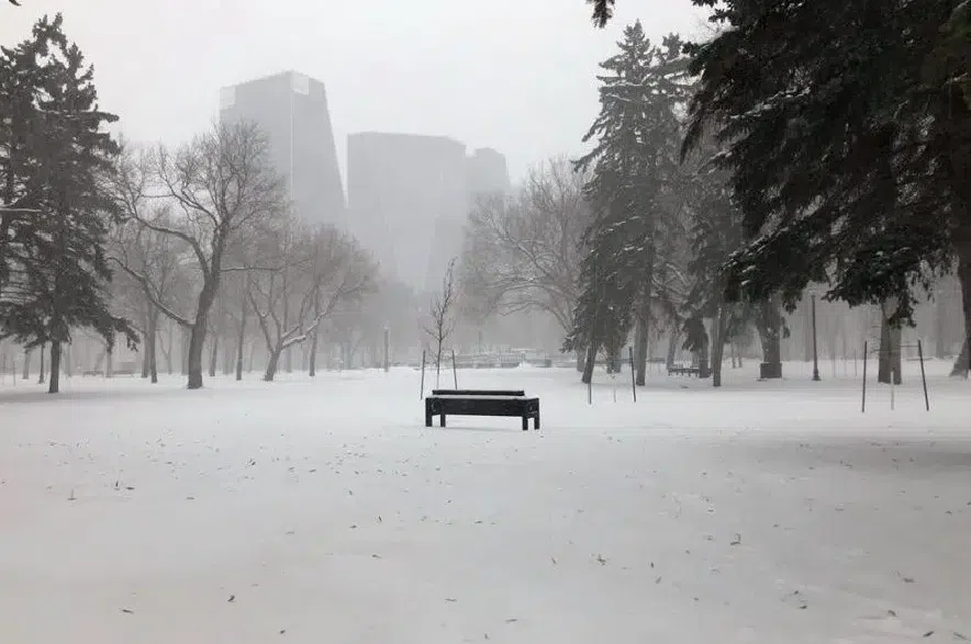
Some very cold weather is hitting central and southern Saskatchewan.
A cold warning from Environment Canada blanketed large parts of the province on Friday, including Regina, Saskatoon, Swift Current, Kindersley, Yorkton, North Battleford, Prince Albert, Lloydminster, Meadow Lake and the surrounding areas.
Read more:
According to Environment Canada’s forecasts, Regina can expect a high of -24 C on Friday, followed by an overnight low of -30 C. In Saskatoon, the daytime high is -25 C, with a low of -32 C expected on Friday night.
Meteorologist Shannon Moodie said the wind chills are expected to be close to -40 C on Friday in many parts of the province.
“We saw the wind chills enter the region last night, and they’ll linger through this morning,” said Moodie.
“There will be some improvement through the day, but unfortunately, they are going to come back for another night for most regions.”
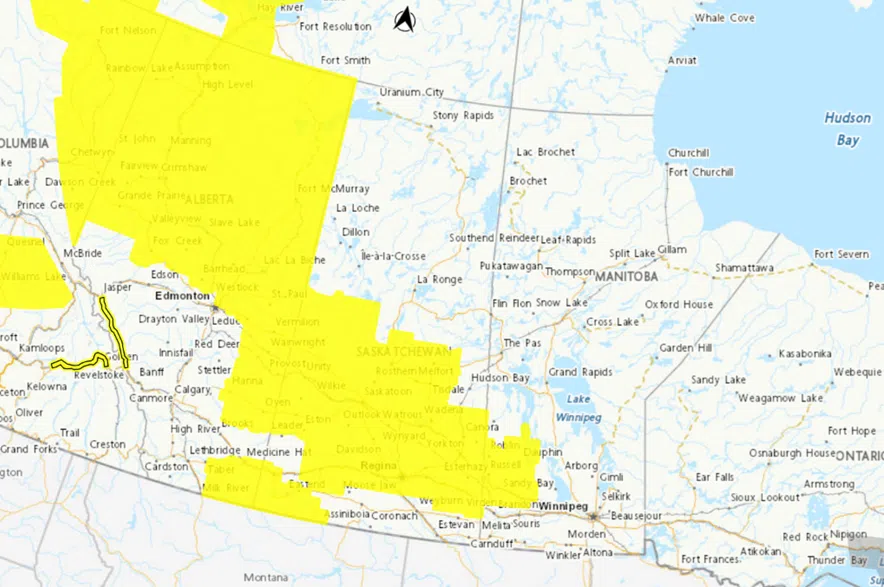
Large parts of Saskatchewan were covered by cold and snowfall warnings on Friday as a cold snap descends on the province. (Environment Canada)
Moodie said the frigid weather is coming from a very cold ridge of Arctic air that’s sliding into Saskatchewan from Alberta.
“It’s bringing a very cold Arctic air mass and some pretty gusty winds,” the meteorologist said.
“The cooler temperatures, combined with those winds, are leading to some pretty cold wind-chill values.”
Moodie said it’s important to bundle up if you’re going outside in extreme cold.
“Dress in layers, cover up, don’t leave any skin exposed. Often you’ll get these really cold temperatures and it’ll be lighter winds, and it doesn’t feel quite as bad, but we do have some gusty winds today, so you’re really going to feel that cold,” she said.
“Watch for any cold-related symptoms, any tingling, any redness, and just cover your skin and really limit your outside time – and your pets’ as well.”
Moodie said the frigid wind-chills are expected to end by Saturday afternoon. By Sunday afternoon, some areas, including Regina, could see a swing in temperatures of around 20 degrees.
“After this ridge departs, there’s going to be a series of systems that are going to be traversing the prairies,” Moodie explained.
“Those systems are going to pull up some warmer air from the south. It is just a really active weather pattern that we’ve been stuck in for the past few days.”
The cold snap comes after a series of weather warnings hit southern Saskatchewan earlier this week, bringing freezing rain, strong winds, and snow to the province, as well as a dump of snow on Thursday in both Saskatoon and Regina.
In addition to the widespread cold warnings, a snowfall warning from Environment Canada was in effect in the southwestern corner of the province, covering areas around Maple Creek, Eastend, Frontier, Climate and Consul. Between 10 and 20 centimetres of snow is expected to fall in the area between Friday afternoon and Saturday morning.
The latest updates on the weather alerts can be found on Environment Canada’s website, and current information on road conditions can be found on the Saskatchewan Highway Hotline.


")
