


Sarah Mills: FIFA seems to be incapable of integrity
After FIFA lifted a red-card suspension for an American player at the World Cup, Sarah Mills says fans are left with que...
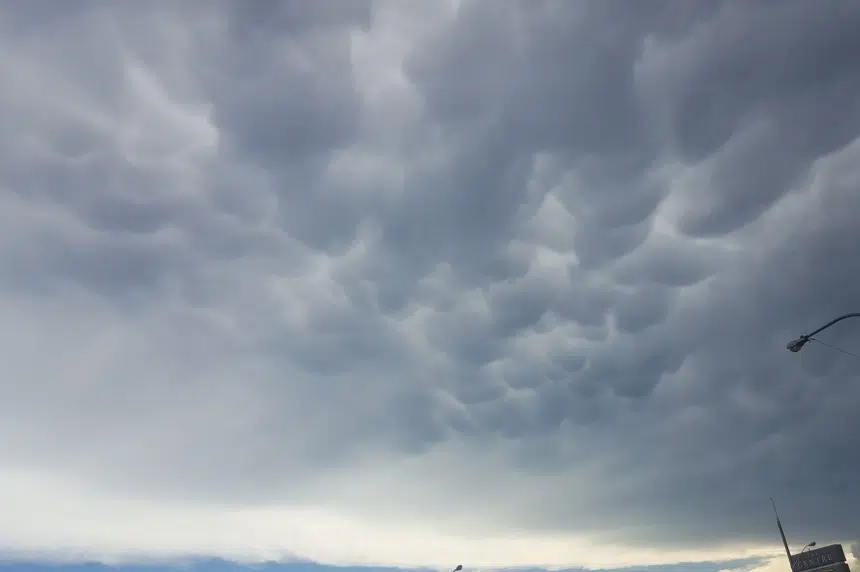
A tornado warning issued Wednesday for areas around Montmartre and Vibank has been lifted.
The warning was issued by Environment Canada just before 6 p.m. It was lifted shortly after 6:15 p.m.
The weather service said meteorologists were tracking a severe thunderstorm that could produce a tornado.
Thought I’d hop in the golf cart and get out of the yard to check this out #skstorm pic.twitter.com/ozponMrrIU
— Jordon (@Jordon77) August 13, 2020
Environment Canada’s Terri Lang said rotation was appearing on their radar.
“A couple thunderstorms have developed and are getting a little more energetic,” Lang said before the warning was lifted. “There are also storm-chasers in the area and they can see that the storm is starting to change a little bit and is at risk of developing into a tornado.”
She said as of 6 p.m., there weren’t any reports of funnel clouds or tornadoes that touched down but the warning was issued out of an abundance of caution.
“The storm is rotating and those are the first stages of when a tornado can develop,” Lang said.
Lang said as soon as the warning is issued, people should start taking precautions which include going to the basement, getting into an interior room, going inside and taking all the precautions people need to.
Lang said there are some active storm cells south of Regina and active cells in the southeast corner as well.
“Peak heating time is around 5 p.m. in the afternoon and that is the real magic hour when storms can develop and once they develop, they tend to go on for a number of hours before sort of fizzling out or lasting into the night,” Lang said.
Environment Canada has been warning for most of the day that severe thunderstorm watches could be upgraded to tornado watches for areas of southern and central Saskatchewan.
The service sent out thunderstorm watches Wednesday morning for areas around Regina, Carlyle, Oxbow, Carnduff, Bienfait, Stoughton, Yorkton, Melville, Esterhazy, Humboldt, Wynyard, Wadena, Lanigan, Foam Lake, Melfort, Tisdale, Nipawin and Carrot River.
Severe thunderstorm warnings were issued Wednesday afternoon for areas around Assiniboia, Gravelbourg, Coronach, Estevan, Weyburn, Radville, Milestone, Fort Qu’Appelle, Indian Head, Lumsden, Pilot Butte, Moosomin, Grenfell, Kipling, Wawota, Kamsack, Canora, Preeceville, Hudson Bay and Porcupine Plain.
The weather service said the storms may be capable of producing strong wind gusts, large hail and heavy rain.
Lang said heavier thundershowers moved through the Coronach area early Wednesday, giving forecasters an idea of how significant the storms could be.
“The possibility of a tornado does exist today, so people should be more weather aware today than they would be on other days, so listen for warnings that might come up as the day progresses,” Lang said.
“This is going to be a progressive system, so usually things start getting going early on in the afternoon and they’re expected to continue into the evening and improve from west to east as the system progresses into Manitoba.”
Lang said conditions exist for the formation of tornadoes in the areas under the thunderstorm watches, but she couldn’t predict which regions face the biggest threat.
“We’re certainly keeping an eye on it, but those are very, very hard to forecast far in advance,” she said. “It’s sort of like watching a pot of water waiting for it to boil and figuring out where the first bubble is going to come up.”
For more details, visit the Environment Canada alert page.


")
